
US 460 Reconstruction
PIKE COUNTY, KY
TRANSPORTATION
KY 195 - Virginia State Line (9 Miles)
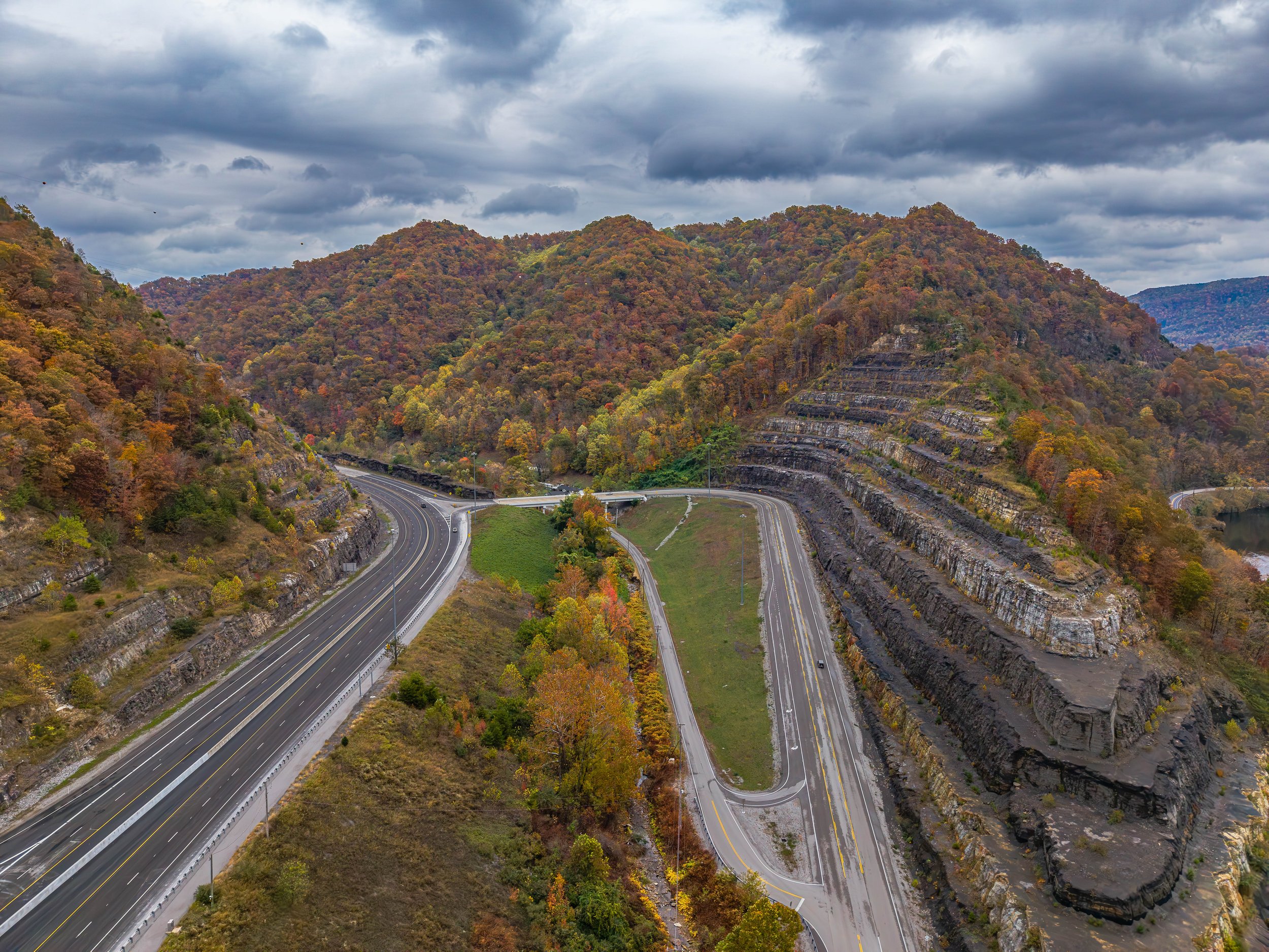
The US 460 Reconstruction Project represents one of the most ambitious and technically complex rural highway undertakings in Kentucky’s history. Serving as lead designer for the Kentucky Transportation Cabinet (KYTC), Palmer Engineering led the planning, environmental documentation, roadway and bridge design, surveying, and expedited right-of-way and mineral rights services necessary to deliver 9 miles of new four-lane highway from KY 195 to the Virginia state line.
This corridor, part of the Appalachian Development Highway System (ADHS), provides a high-speed east-west connection linking Pikeville, KY, to Grundy, VA, and ultimately I-77 near Bluefield. The project modernizes transportation in Central Appalachia by improving safety, reducing travel time, and expanding access to healthcare, education, jobs, and tourism.
Designed through steep mountainous terrain and environmentally sensitive areas, the project required unprecedented levels of engineering innovation — from advanced bridge design and mine-subsidence mitigation to complex utility, railroad, and right-of-way coordination. The corridor includes 11 bridges, over 65 million cubic yards of excavation, and more than 250 acres of future industrial and commercial development sites constructed using controlled fill methods.
With the final segment opening to traffic in October 2025, US 460 now stands as a regional catalyst for economic development, outdoor recreation, and sustainable community growth across Eastern Kentucky and the Appalachian region.
The submission, “Moving Mountains, Connecting Appalachia,” was recognized as the 2026 Grand Conceptor Award winner by ACEC of Kentucky. It was also recognized on the national level at the ACEC Engineering Excellence Awards in Washington, D.C., where it was one of eight projects to receive a Grand Award out of 240 projects submitted nationwide.


Unique Aspects
-
Opportunities
Regional Transformation Through Connectivity: Creates a continuous high-speed east–west route across Central Appalachia, improving access to healthcare, education, recreation, and employment centers
Economic Development at Four Major Sites: More than 250 acres of development-ready land created at excess material sites for industrial, commercial, and residential use
Tourism & Outdoor Recreation Growth: Enhances access to Breaks Interstate Park, the Russell Fork River, mountain biking, ATV trail systems, and regional outdoor adventure destinations
Modern Infrastructure for Long-Term Growth: Supports expanded freight mobility, safer travel, and future community development through improved roadway geometry, interchanges, and bridge infrastructure
Workforce & Industry Support: Strengthens regional workforce pathways through improved connections to training centers and higher education institutions
-
Challenges
Extreme Mountainous Terrain: Designing a 60-MPH four-lane highway through steep slopes required extensive earthwork, rock excavation, and specialized slope stabilization
Environmental Compliance & Sensitive Habitat Protection: Required complex coordination and mitigation for endangered species — including the Big Sandy Crayfish and Indiana Bat — as well as numerous water crossings and permit approvals
Active & Abandoned Coal Mines: Mine subsidence risks influenced alignment decisions, bridge design, and required KYTC’s purchase of mineral rights to permit coal removal and cost-saving excavation
Major Bridge Engineering Complexity: Included Kentucky’s tallest bridge (326 feet), multiple twin structures, incremental girder launching, and advanced geotechnical and structural analysis
Extensive Right-of-Way & Relocation Needs: Involved acquisition of over 165 properties and relocation of nearly 80 families and businesses, requiring careful planning and communication
Utility & Railroad Coordination: Required adjustments for natural gas infrastructure, water lines, electrical transmission towers (including helicopter installations), and hand-dug culvert replacement beneath the CSX railroad
Massive Earthwork & Controlled Fills: Over 65 million cubic yards of excavation had to be efficiently managed while constructing stable, development-ready fill sites
-
Successes
Completion of a High-Speed Appalachian Corridor: 9-mile segment opened to traffic in 2025, completing Kentucky’s portion of Corridor Q and fulfilling a decades-long vision for regional mobility
Engineering Innovation at Statewide and National Scale: Implemented first-in-Kentucky incremental steel girder launching, advanced finite element bridge design, and custom roadway solutions for mountainous terrain
Creation of 250+ Acres of Prime Development Land: Controlled fill sites now offer opportunities for industrial expansion, residential development, and long-term economic growth
Robust Community Engagement & Public Support: Public meetings shaped project decisions — including bridge preferences in the Pond Creek community — resulting in safer access and stronger local buy-in
Environmental Stewardship Achievements: Successful permitting, habitat protection, and mitigation strategies set precedents for Appalachian roadway projects
Significant Tourism & Economic Impact: Improved access supports Breaks Interstate Park, adventure tourism, regional trail systems, and economic initiatives like Southern Gap
High Visibility & Positive Public Reception: Ribbon-cutting ceremony drew over 500 attendees, with social media content reaching nearly 100,000 views — reflecting exceptional community enthusiasm
Decades of Trusted Leadership for KYTC: Palmer Engineering’s long-term involvement ensured continuity, technical excellence, and reliable delivery on one of Kentucky’s largest rural transportation investments
Key Team Members
-

David Lindeman, PE, PLS
PROJECT MANAGER
-

Jeff Cowan, PE, CPESC
PROJECT MANAGER
-

Brad Robson, PhD, PE, SE
PROJECT MANAGER
-

David Deitz, PhD, PE, SE
PROJECT MANAGER
-

Stephen Sewell, PE, PTOE
TEAM MEMBER
-

David Lanham, PE
TEAM MEMBER