
The Role of Surveying in Transportation Projects

Before engineers design a road, bridge, or intersection improvement, they must first understand exactly what exists on the ground. That process begins with surveying.
Surveyors measure and map the physical world around us—on land, in the air, and even underwater. Using specialized equipment and advanced technology, surveyors collect precise data about terrain, structures, utilities, and property boundaries. This information helps ensure accuracy and order in the built environment and plays a critical role in land development.
From roads and bridges to cities and utility systems, surveying provides the foundation for nearly every infrastructure project. For transportation projects in particular, accurate survey data allows engineers to evaluate existing conditions, identify potential conflicts, and design improvements that are safe, efficient, and compatible with the surrounding environment.
At Palmer Engineering, surveying has been at the heart of our work since the firm was founded in 1969. Today, our survey team provides a wide range of services to support transportation projects across Kentucky and the region, helping agencies and communities make informed decisions from the earliest stages of project development.
Survey technician Will Graves describes the profession this way:
“Surveying sits at the intersection of working outdoors and solving technical challenges. There’s something meaningful about measuring and mapping the world with accuracy and translating it into data engineers rely on.”
Why Surveying Matters for Transportation Projects
Transportation infrastructure must be designed with a clear understanding of existing conditions. Roads, bridges, drainage systems, utilities, and surrounding properties all interact within the same physical space. Surveying provides the detailed information engineers need to plan improvements that work safely and efficiently within that environment.
Accurate survey data allows transportation agencies and engineers to:
Understand existing terrain and roadway conditions
Identify underground utilities and potential conflicts
Establish property boundaries and right-of-way limits
Evaluate drainage and stormwater flow
Develop precise digital terrain models for design
Without reliable survey information, engineers would be designing infrastructure without a complete picture of the project area. That could lead to design conflicts, construction delays, or costly adjustments later in the project.
By collecting accurate field data at the beginning of a project, survey teams help ensure that transportation improvements move forward with confidence and precision.
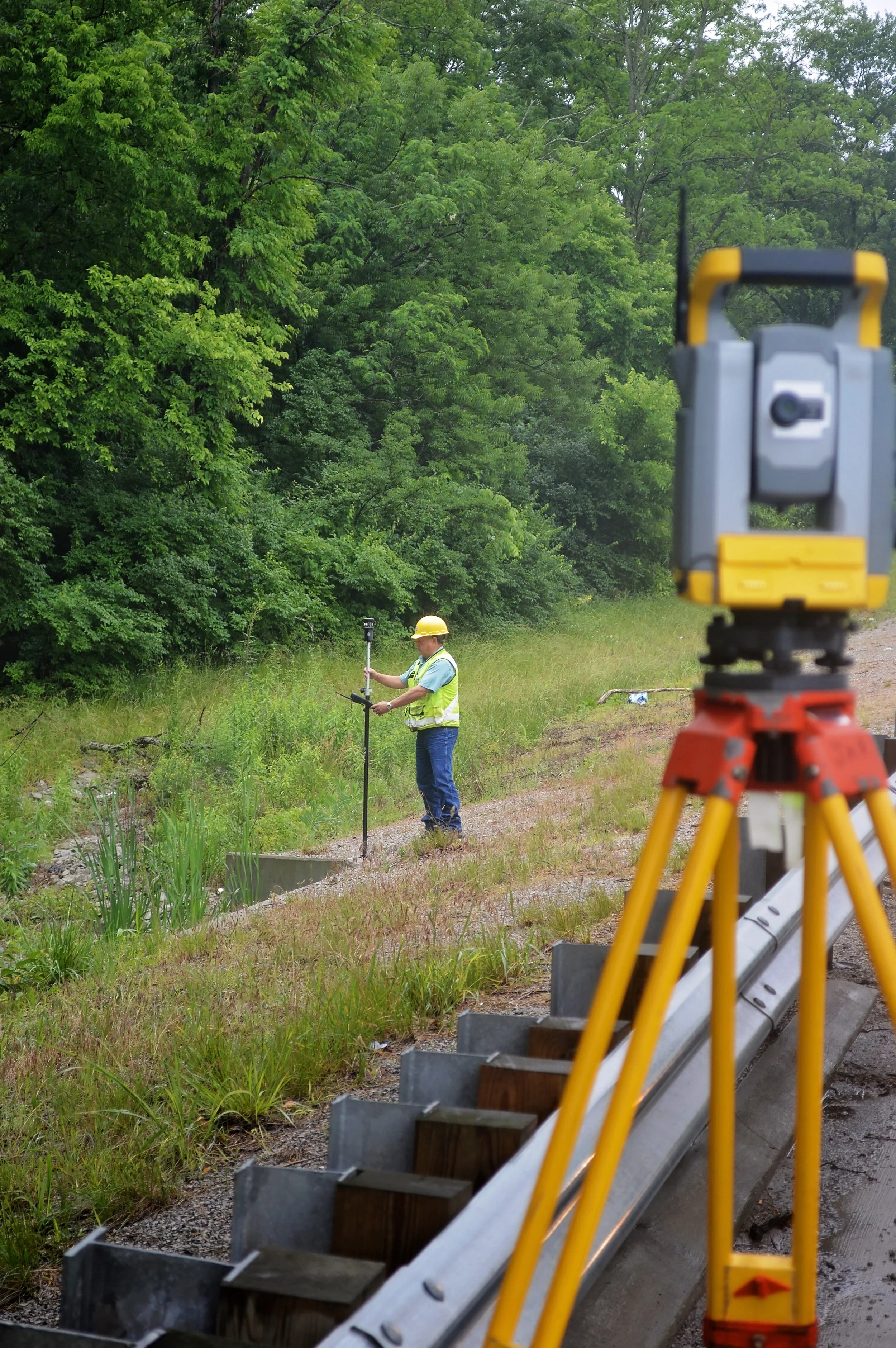
Control Surveys
Control surveys establish precise horizontal and vertical reference points that serve as the framework for all other survey work. These control points ensure that mapping, design, and construction activities align within a consistent coordinate system.
For transportation projects, control surveys are essential for maintaining accuracy across large project areas and ensuring consistency between field data, engineering models, and final construction plans.
While the tools used in surveying have advanced significantly over time, the underlying principles remain the same. Surveyors rely on known reference points to accurately determine the position of features across a project area, creating the reliable spatial framework that engineers depend on for design and construction.
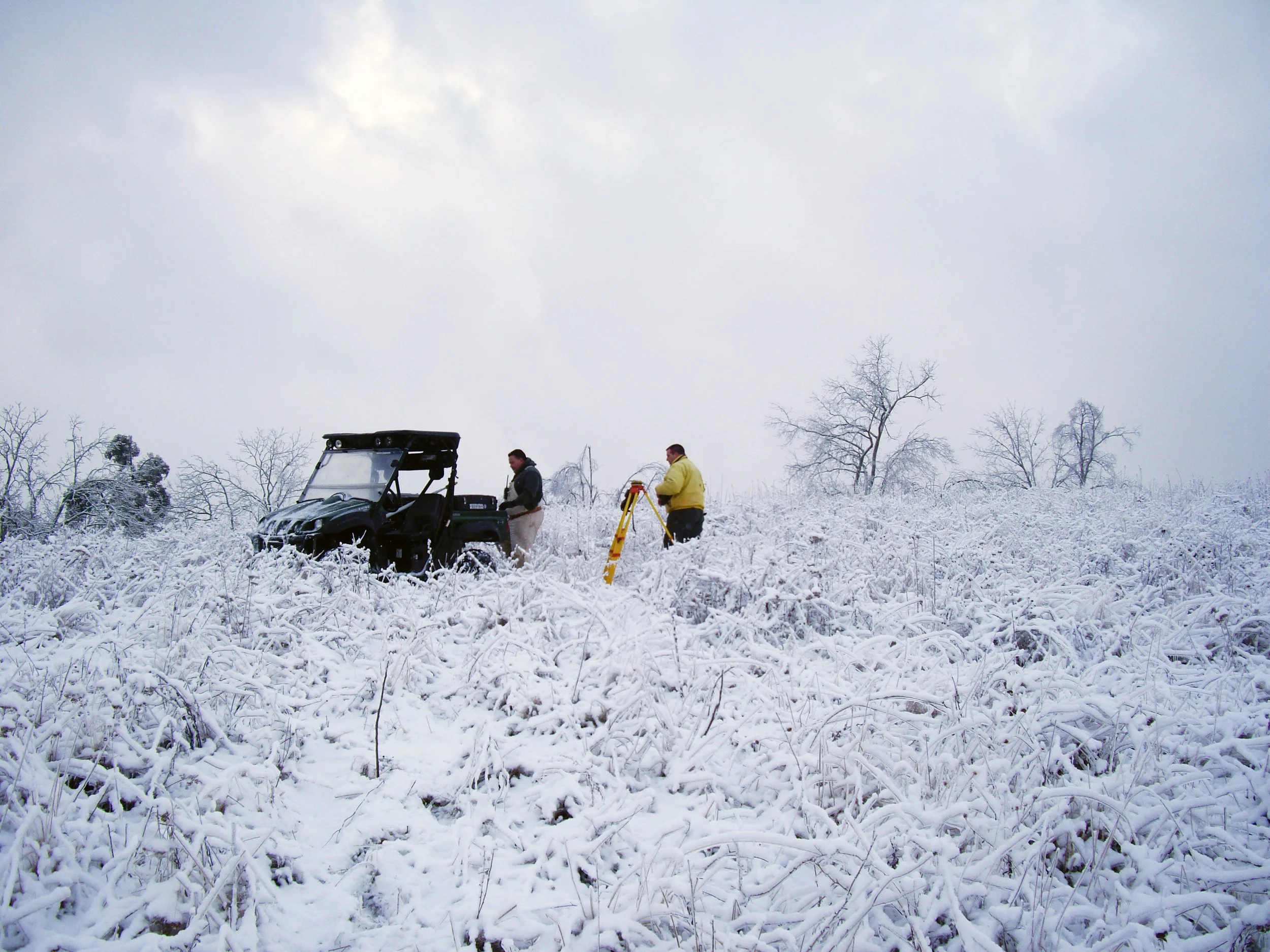
Topographic Surveys
Topographic surveys capture detailed information about existing ground conditions and site features. Using advanced equipment and data collection techniques, surveyors map terrain elevations, drainage features, utilities, pavement edges, and other physical elements along transportation corridors.
This data allows engineers to develop accurate digital terrain models and design roadway improvements that work with existing conditions. Topographic surveys are commonly used for highway widening projects, intersection improvements, and corridor studies.
Because survey data must reflect real-world conditions, field crews often work in a wide range of environments and weather conditions—from hot summer days to winter storms. Collecting accurate measurements in the field requires both technical skill and adaptability, ensuring that engineers receive reliable information regardless of the conditions.
Many surveyors appreciate the unique blend of outdoor work and technical analysis involved in this type of surveying. Brian Ward, PE, PLS, notes that this balance is one of the reasons he enjoys the profession.
Professional Judgment and Responsibility
While modern technology has transformed the tools surveyors use, the profession still depends on careful judgment and professional responsibility. Accurate data is essential because engineers, contractors, and communities rely on it throughout the life of a project.
As David Shain, PE, PLS, notes, professionalism plays an important role in the work surveyors perform every day.
“Think of yourself as a professional. That mindset helps you make good decisions in the field,” said Shain.
Surveying also requires a strong commitment to accuracy and ethical decision-making, even when projects involve tight schedules or complex conditions. According to Jody Barker, PLS, those professional standards are essential to the work surveyors do.
“Your integrity is up to you.”
Even with advanced technology, experienced surveyors remain responsible for verifying data, interpreting historical records, and ensuring that measurements accurately represent existing conditions.
Property and Right-of-Way Surveys
Transportation improvements often require evaluating property boundaries and right-of-way limits. Property surveys identify existing boundaries and help determine where additional right-of-way or easements may be required for roadway improvements.
These surveys also help resolve property line questions, assist with land acquisition processes, and ensure that projects comply with legal property requirements.
Surveying also plays an important role in protecting property rights and ensuring that infrastructure projects are built responsibly and accurately.

LiDAR and Drone Mapping
Advances in technology have transformed how transportation surveys are performed. Mobile and terrestrial LiDAR scanning and drone mapping allow survey teams to collect millions of data points quickly and safely.
These technologies create detailed 3D models of project corridors and structures, capturing features that may be difficult or dangerous to measure using traditional methods. The resulting point clouds and terrain models provide engineers with highly accurate data for design and analysis.
Survey technician Will Graves notes that the profession is increasingly driven by digital data and modeling.
“Surveyors today need to understand not just measurement, but data systems. The profession is shifting from being primarily data collectors to becoming data managers and spatial analysts.”
Subsurface Utility Engineering (SUE)
One of the most important components of modern transportation surveying is identifying underground utilities before construction begins. Subsurface Utility Engineering combines records research, field detection, and advanced technologies to locate utilities such as water lines, gas mains, and fiber optic cables.
Tools such as Ground Penetrating Radar (GPR) and vacuum excavation allow survey teams to confirm the exact location and depth of utilities. Identifying these conflicts early helps reduce construction risks, minimize project delays, and protect existing infrastructure.
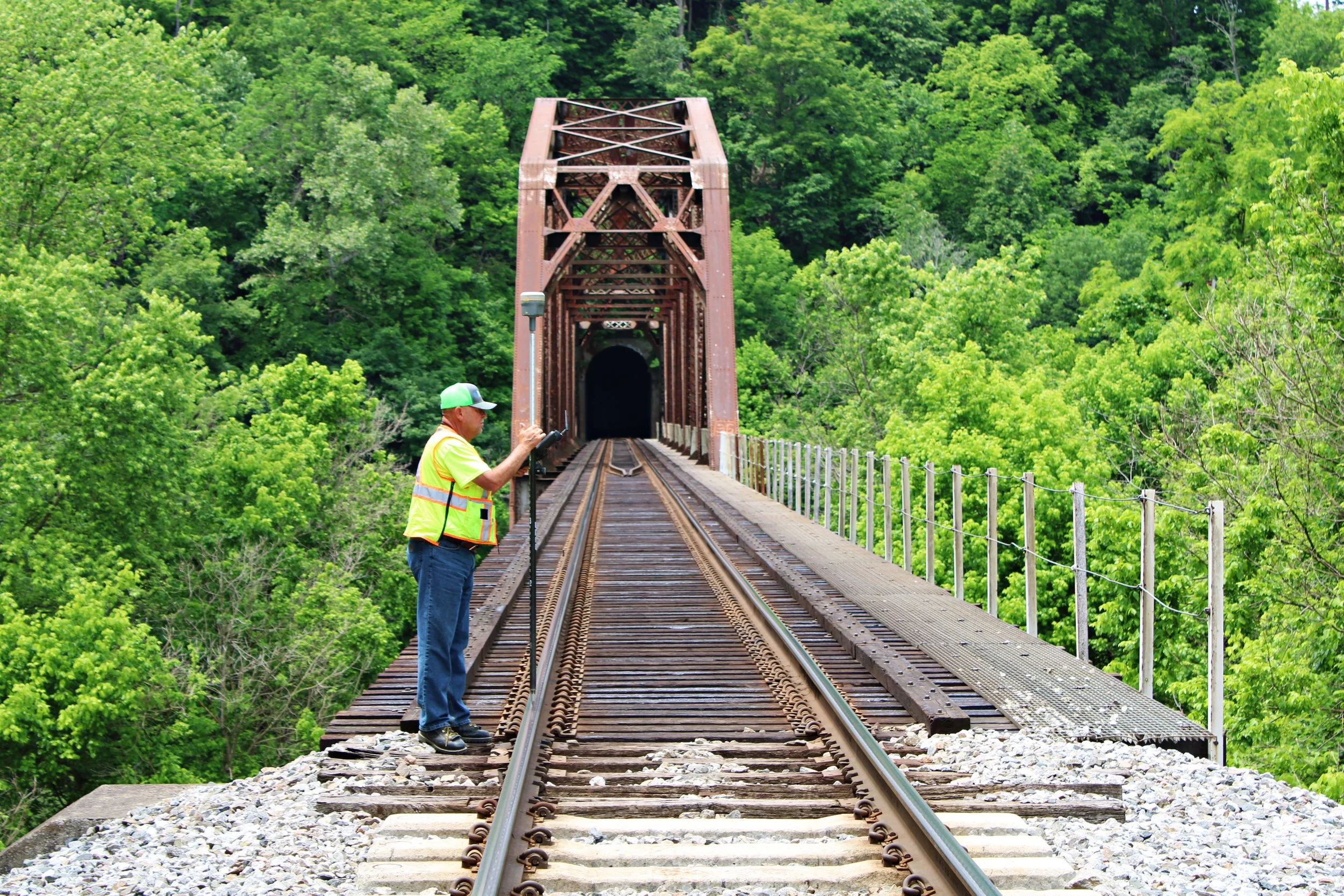
Bridge and Structure Surveys
Bridge replacement or rehabilitation projects require specialized survey techniques to capture structural details and surrounding terrain. Survey teams collect elevation data on beams, bridge seats, utilities, and floodplain sections to support hydraulic modeling and structural design.
These surveys are often completed on accelerated schedules, especially following emergency events such as flood damage, allowing transportation agencies to quickly restore critical infrastructure and reconnect communities. In situations like these, accurate survey data is essential for helping engineers quickly understand existing conditions and move projects from assessment to design.
Following the devastating flooding that impacted Eastern Kentucky in July 2022, Palmer Engineering was assigned 11 bridge replacement projects across Districts 10 and 12 in Breathitt, Knott, Letcher, and Perry Counties. In addition to structure plans, Palmer was responsible for delivering the full range of discipline submittals needed to move the replacements into construction as quickly as possible. These services included surveying, environmental approvals, right-of-way coordination, maintenance of traffic and diversion design, stream hydraulics, utility coordination, roadway design, and bridge design.
To meet the urgent needs of the affected communities, survey and design work was completed under extremely tight schedules. For two of the bridge assignments, Palmer provided all contract documents required for a Kentucky Transportation Cabinet letting within just seven days of receiving notice to proceed. Since then, the projects have moved forward through the design and construction process, helping restore critical connections for communities affected by the flooding.
Supporting Better Transportation Projects
From mapping road corridors to locating underground utilities, surveying provides the essential data that supports every stage of transportation design and construction. By combining experienced professionals with the latest technology, survey teams help ensure that projects are delivered efficiently, safely, and accurately.
At Palmer Engineering, surveying remains the first building block of every successful transportation project—providing the reliable information engineers need to plan, design, and deliver infrastructure improvements.
As Craig Palmer, PLS, puts it:
“Surveying quietly supports nearly everything we build, buy, or depend upon.”